
Keyword
Gear Trials: IN2020_E01
12 record(s)
Type of resources
Topics
Keywords
Contact for the resource
Provided by
Formats
Update frequencies
Status
draft
-

This record describes magnetometer data collected on RV Investigator voyage voyage IN2020_E01 (Trials and Calibration) which departed Hobart on the 29th July 2020 and returned to Hobart on the 6th August 2020. The purpose of this voyage was to undertake post port-period equipment calibrations and commissioning, sea trials and personnel training. The SeaSPY2 magnetometer uses an omnidirectional Overhauser sensor that requires no realignment or recalibration and has no heading error. The instrument has an absolute accuracy of 0.1 nT, sensor sensitivity of 0.01 nT and resolution of 0.001 nT. Data are stored in .CSV and .MMS data files at CSIRO. 0.68 MB of raw data was acquired in this dataset. No processing has been conducted on this data. The magnetometer was towed 300 m astern of the ship and a layback value of 361 m was applied to the magnetometer data. This was the total distance behind the ship's positioning reference point. Note: The magnetometer was only deployed for a short period (between 23:04 & 23:51 on the 03/08/2020 - UTC) for training purposes only. Additional information regarding this dataset is contained in the GSM data acquisition and processing report.
-
This record describes SVP data collected on IN2020_E01 (Trials and Calibration) which departed Hobart on the 29th July 2020 and returned to Hobart on the 6th August 2020. The purpose of this voyage was to undertake post port-period equipment calibrations and commissioning, sea trials and personnel training. A total of 7 SVP casts were conducted over the duration of this voyage using the Valeport rapidSV profiler. Data are stored in ASCII format files with extension *.txt at CSIRO. A total of 5 SVP casts were conducted over the duration of this voyage using the Valeport Midas SVX2 profiler. Data are stored in ASCII format files with extension *.000 at CSIRO. Additional information regarding this dataset is contained in the GSM data acquisition and processing report. Additional data products may be available on request.
-
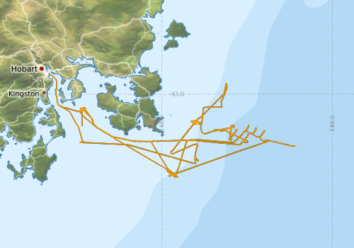
This record describes multibeam echosounder data collected on RV Investigator voyage IN2020_E01 (Trials and Calibration) which departed Hobart on the 29th July 2020 and returned to Hobart on the 6th August 2020. The purpose of this voyage was to undertake post port-period equipment calibrations and commissioning, sea trials and personnel training. The Kongsberg EM710 MKII multibeam echosounder was used to acquire seafloor bathymetry and backscatter information and watercolumn backscatter in Storm Bay and offshore to the southeast of Tasman Peninsula. A patch test calibration was performed to determine the angular offsets of the system on July 30, 2020. The EM710 MKII provides a 0.5° by 1° transmit and receive angular resolution respectively. The echosounder's nominal frequency range is from 40 to 100 kHz and during this voyage was acquired with a frequency range setting of 70 to 100 kHz. Data are stored in *.all raw format for bathymetry and backscatter and *.wcd format for watercolumn backscatter at CSIRO. There are 122 files totalling 12.4 GB of raw bathymetry (.all) data and 118 files totalling 89.3 GB of raw watercolum (.wcd) in this dataset. Sound velocity profiles were applied to this data during data acquisition. Bathymetry data contained in *.all format are corrected for motion and position. Tide corrections were not applied to all of the the processed data. GPS tide was applied to files 0083, 0085, 0087, 0090, 0092, 0096, 0098, 0100 & 0103 (bathymetry reference surface lines) and files 0031, 0033, 0035, 0037, 0040, 0042, 0044 (patch test lines). Processed data has had outliers removed. Processed line data are available in *.gsf and ascii format, and processed bathymetry in geotiff format. Additional information regarding this dataset, including further information on processing streams, is contained in the GSM data acquisition and processing report. Additional data products may be available on request.
-
This record describes XBT data collected on RV Investigator voyage IN2020_E01 (Trials and Calibration) which departed Hobart on the 29th July 2020 and returned to Hobart on the 6th August 2020. The purpose of this voyage was to undertake post port-period equipment calibrations and commissioning, sea trials and personnel training. A total of 1 XBT casts were conducted over the duration of this voyage. Data are stored in netCDF files at CSIRO. Additional information regarding this dataset is contained in the GSM data acquisition and processing report. Additional data products may be available on request.
-
This record describes scientific split-beam echosounder data collected on the RV Investigator voyage IN2020_E01 (Trials and Calibration) which departed Hobart on the 29th July 2020 and returned to Hobart on the 6th August 2020. The purpose of this voyage was to undertake post port-period equipment calibrations and commissioning, sea trials and personnel training. The Simrad EK80 wide band transceivers (WBT) 18, 38, 70, 120, 200 and 333 kHz and the EK60 split-beam GPT 333 kHZ were calibrated at the start of this voyage at anchor in the Derwent Estuary on July 29, 2020. The EK80 WBTs were calibrated using default settings for both CW and FM modes. The EK80 system was then used to acquire acoustic backscatter data to a range of 1500 m for the remainder of the voyage offshore to the southeast of Tasman Peninsula. The EK60 split-beam GPTs for 18, 70, 120 and 200kHz were calibrated at anchor in the Derwent Estuary at the end of the voyage on August 6th, 2020. All frequencies were logged sporadically for the extent of the voyage. The frequencies were set to passive for periods during the voyage when conducting other system calibrations. Data are stored in *.raw, *.bot and *.idx format at CSIRO. There are 1,061 files totalling 99.9 GB of raw data in this dataset. No processing has been conducted on this data. Additional information regarding this dataset is contained in the GSM data acquisition and processing report. Additional data products may be available on request.
-
This record describes multibeam echosounder data collected on RV Investigator voyage IN2020_E01 (Trials and Calibration) which departed Hobart on the 29th July 2020 and returned to Hobart on the 6th August 2020. The purpose of this voyage was to undertake post port-period equipment calibrations and commissioning, sea trials and personnel training. The Kongsberg EM122 multibeam echosounder was used to acquire seafloor bathymetry, backscatter information and watercolumn backscatter in Storm Bay and offshore to the southeast of Tasman Peninsula. The EM122 provides a 1 degree by 1 degree angular resolution. The echosounder's nominal frequency is 12 kHz. A patch test calibration was performed to determine the angular offsets of the system on August 1st, 2020. Data are stored in *.all raw format for bathymetry and backscatter and *.wcd format for watercolumn backscatter at CSIRO. There are 98 files totalling 3.72 GB of raw data in this dataset. Sound velocity profiles were applied to this data during data acquisition. Bathymetry data contained in *.all format are corrected for motion and position. Tide corrections were not applied to the processed data. Processed data had outliers removed. Processed line data are available in *.gsf and ascii format, and processed bathymetry and backscatter grids in geotiff format. Additional information regarding this dataset, including information on processing streams, is contained in the GSM data acquisition and processing report. Additional data products may be available on request.
-
This record describes gravity data collected on RV Investigator voyage IN2020_E01 (Trials and Calibration) which departed Hobart on the 29th July 2020 and returned to Hobart on the 6th August 2020. The purpose of this voyage was to undertake post port-period equipment calibrations and commissioning, sea trials and personnel training. The gravity meter instrument is a MicroG Lacoste Air-Sea II. Data are stored in .ENV and .DAT data files at CSIRO. There are 13 files totalling 167MB of raw data in this dataset. A wharf tie was undertaken at the wharf in Hobart using a Scintrex Autograv CG-5 on July 20, 2020. Wharf tie data can be found in Hobart wharf_tie_2020_07_20.TXT, which is stored with the raw data. No processing has been conducted on this data. Additional information regarding this dataset is contained in the GSM data acquisition and processing report.
-
This record describes the Underway (UWY) data collected from the Marine National Facility (MNF) RV Investigator Voyage IN2020_E01, titled: "Trials and Calibration" The voyage took place between July 29 and August 7, 2020 departing from Hobart (TAS) and returning to Hobart (TAS). Standard Underway data is continuously recorded, consisting of: (1) Navigation data (NAV): Latitude, Longitude, Speed, Heading, Course Over Ground, Gyros, and Doppler Log (dual GPS instrument). (2) Thermosalinograph (TSG): Water Salinity, Flow-Rate, Temperature, Fluorescence, pCO2 and Optode/Oxygen. (3) Atmospheric (MET): Humidity, Wind Speed and Direction (vane and ultrasonic), Radiometer/Sea Surface Temperature, Pyranometer/Solar Radiation, Photosynthetically Active Radiation (PAR), Air Temperature, Air Pressure, Rain, Ozone and Trace Gases (port and starboard instruments). The quality-controlled RV Investigator underway meteorological and SST data are supplied to the IMOS AODN where they are publicly available at the "Ships of Opportunity" Thredds server (http://thredds.aodn.org.au/thredds/catalog/IMOS/SOOP/SOOP-ASF/VLMJ_Investigator/catalog.html) for research. From there, they are downloaded by NOAA for their In Situ Quality Monitoring web site (iQUAM2) and made available for satellite SST validation. The SBE 38 SST data are used within the Australian Bureau of Meteorology for real-time satellite SST validation and ingested into real-time SST analyses which are then used as the boundary condition for Numerical Weather Prediction models. The meteorological and SST data are uploaded onto the Global Telecommunications System (GTS) for global dissemination to Meteorological Agencies, and separately supplied to the SAMOS (http://samos.coaps.fsu.edu/html/) Project for air-sea flux research. The real-time SBE 38 SST data are currently (2017) used in the following data products (accessed via the GTS): • International Comprehensive Ocean-Atmosphere Data Set (ICOADS R3.0) (http://icoads.noaa.gov/) • NOAA NCEI Extended Reconstructed Sea Surface Temperature version 4 (ERSST.v4) (https://www.ncdc.noaa.gov/data-access/marineocean-data/extended-reconstructed-sea-surface-temperature-ersst-v4) • Hadley Centre SST Data Set (HadSST3) (http://www.metoffice.gov.uk/hadobs/hadsst3/) • Global Ocean Surface Underway Data (GOSUD) Project (http://www.gosud.org/) • Bureau of Meteorology daily and weekly SST analyses (http://www.bom.gov.au/marine/sst.shtml) • NOAA NCEI “Reynolds” daily global OISST analysis (https://www.ncdc.noaa.gov/oisst) • NASA JPL “MUR” 1 km daily global SST analysis (https://mur.jpl.nasa.gov/) • UK Met Office “OSTIA” daily global SST analysis (http://ghrsst-pp.metoffice.com/pages/latest_analysis/ostia.html) • CMC daily global SST analysis • Ourocean “G1SST” global daily 1 km SST analysis (https://ourocean.jpl.nasa.gov/SST) As part of the underway data gathering system, other datasets are produced (e.g., pCO2, ISAR SST) which are processed separately and have their own metadata records. Data are recorded at 5 second intervals. Near real-time data are available via the link "Visualisation tool for Underway Data." This dataset will be processed and archived within the CSIRO Oceans & Atmosphere (O&A) Information and Data Centre (IDC) in Hobart (TAS). Data are available at time intervals of 5 sec (NetCDF format), 10 sec and 5 min (ASCII format). Additional information regarding this dataset is contained in the Voyage Summary and/or the Data Processing Report for this voyage.
-
This record describes some Underway (UWY) data collected from the Marine National Facility (MNF) RV Investigator, which are not part of research datasets and have not been processed or quality-controlled. This includes data from most "Gear trials" voyages (identified by the survey name suffix "_eNN"). Underway data from these voyages are usually not processed unless requested. While RV Investigator is at sea, standard Underway data are continuously recorded, consisting of: (1) Navigation data (NAV): Latitude, Longitude, Speed, Heading, Course Over Ground, Gyros, and Doppler Log (dual GPS instrument). (2) Thermosalinograph (TSG): Water Salinity, Flow-Rate, Temperature, Fluorescence, pCO2 and Optode/Oxygen. (3) Atmospheric (MET): Humidity, Wind Speed and Direction (vane and ultrasonic), Radiometer/Sea Surface Temperature, Pyranometer/Solar Radiation, Photosynthetically Active Radiation (PAR), Air Temperature, Air Pressure, Rain, Ozone and Trace Gases (port and starboard instruments). During the voyage, near real-time data are available from the MNF tool NRUD (Near Real-Time Underway Data) via the link "Visualisation tool for Underway Data" below. To request access after the voyage please contact the data custodian. The Underway data collected during research voyages (identified by the survey name suffix "_vNN") are processed and quality-controlled by the Marine National Facility (MNF). The processed datasets from these voyages are made available at time intervals of 5 sec (NetCDF format), 5 sec, 10 sec, 1 min and 5 min (ASCII/CSV format) through a voyage-specific metadata record. Additional information regarding processed datasets is available in the Voyage Summary and/or the Data Processing Reports linked to the relevant metadata records.
-
This record describes the End of Voyage (EOV) archive from the Marine National Facility (MNF) RV Investigator research voyage IN2020_E01, titled "Trials and Calibration." The voyage took place from Hobart (TAS) to Hobart between July 29 and August 6, 2020 (AEST). For further information please refer to the voyage documentation links below. Instruments used and data collected include: Regular measurements: Acoustic Doppler Current Profiler (ADCP; 75, 150 KHz ), Cloud Condensation Nuclei counter (CCN), Condensation Particle Counters (CPC), Disdrometer, Greenhouse Gas Analysers (Picarro), Radon and Ozone sensors, Scanning Mobility Particle Sizers (SMPS), CTD, Hydrochemistry, Gravimeter, pCO2, Fisheries echosounder (EK60), Multibeam Echosounder (EM710, EM122), Sub-bottom Profiler (SBP120), GPS Positioning System, Doppler Velocity Log, Fluorometer, Oxygen optode, Thermosalinographs (TSG), Infrared Sea Surface Temperature Autonomous Radiometer (ISAR), Multiangle Absorption Photometer (MAAP), Nephelometer, Atmospheric Temperature, Humidity, Pressure, Wind and Rain sensors, Photosynthetically Active Radiation (PAR) sensor, Precision Infrared Radiometer (PIR), Precision Spectral Pyranometer (PSP), Starboard and Portside Radiometers, Weather Radar. Voyage-specific measurements: ITI Trawl net, Ultra Short BaseLine Underwater Positioning System (USBL), Deep Towed Camera (DTC). The archive for the IN2020_E01 EOV raw data is curated by the CSIRO NCMI Information and Data Centre (IDC) in Hobart, with a permanent archive at the CSIRO Data Access Portal (DAP, https://data.csiro.au/dap/), providing access to participants and processors of the data collected in the voyage. All voyage documentation is available electronically to MNF support via the local network. Access to voyage documentation for non-CSIRO participants can be made via NCMI_DataLibrarians@csiro.au.